-
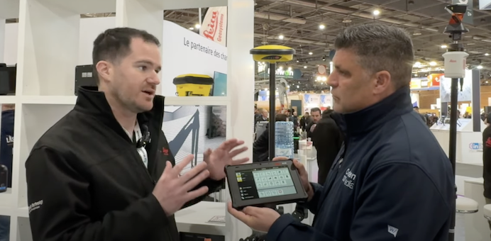
29/11/2024 Leica Geosystems reveal new products and Xwatch acquisition at Intermat Paris
Peter Haddock talks to Thomas Bonvalot about the new Intelligent Antenna and smart tablet, which will have huge advantages for machine control users and surveyors.
-
29/11/2024 Houlihan purchase Hitachi excavators with factory fit Leica Geosystems machine control
The Sunbury on Thames-based Groundworks and Civil Engineering company has purchased a range of Hitachi tracked excavators, including one ZX210LC-7 and four ZX130LCN-7’s.
-
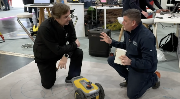
29/11/2024 Revolutionary HP SitePrint makes its deput in Intermat Paris on the Leica Geosystems stand
Revolutionary HP SitePrint Robot at Intermat Paris prints text and blueprints onto a construction site.